Since last post I continued up the Intracoastal waterway for several days, motoring a lot but also motor-sailing, which is when there is a light wind so I can put up the sails, but still have the motor running at a lower rpm. This way I can go at a decent speed but use less fuel since the sails help push the boat along.
One interesting place I motored through was a dredged canal called the Alligator River Pungo River canal. This 21 mile canal was built in the 1950s to drain the area for farmland. Supposedly there are deer, bears and alligators there, but I didn’t see any. Here’s a short video clip.
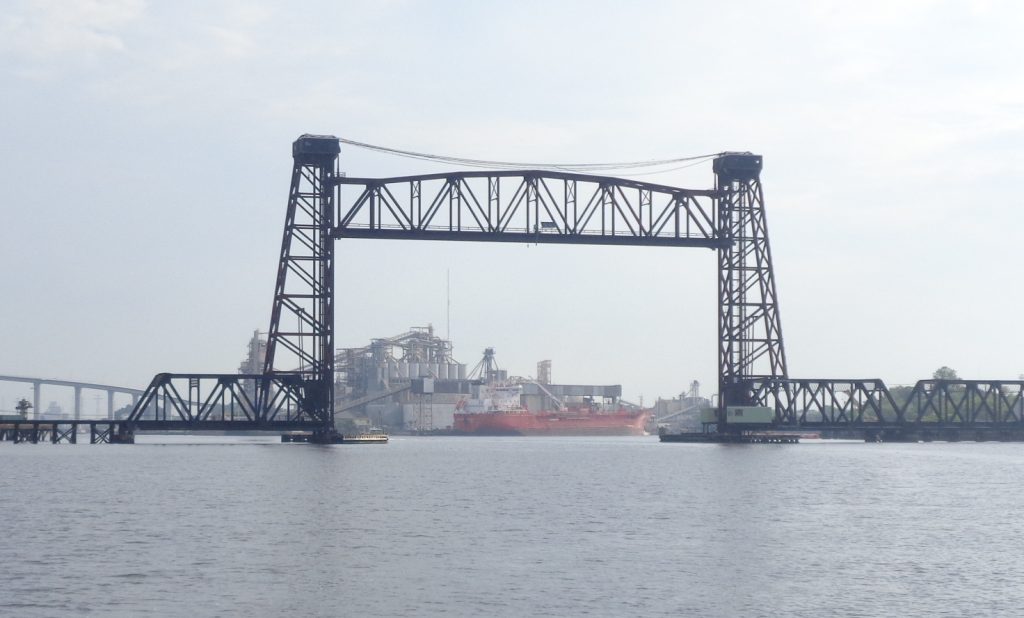
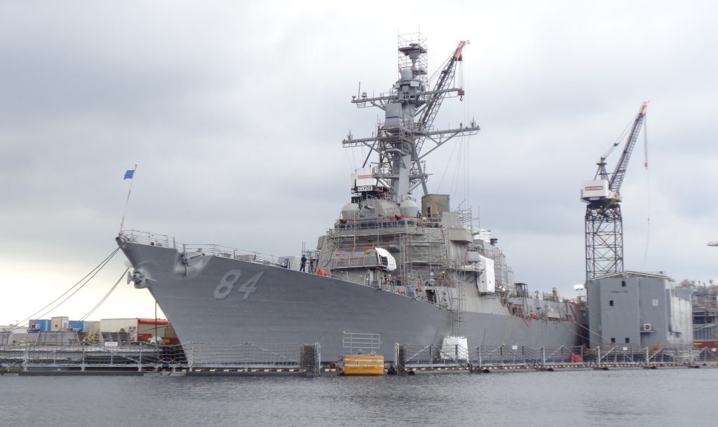
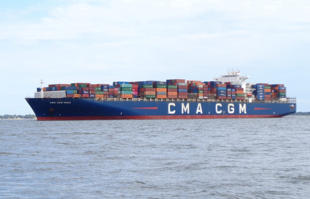
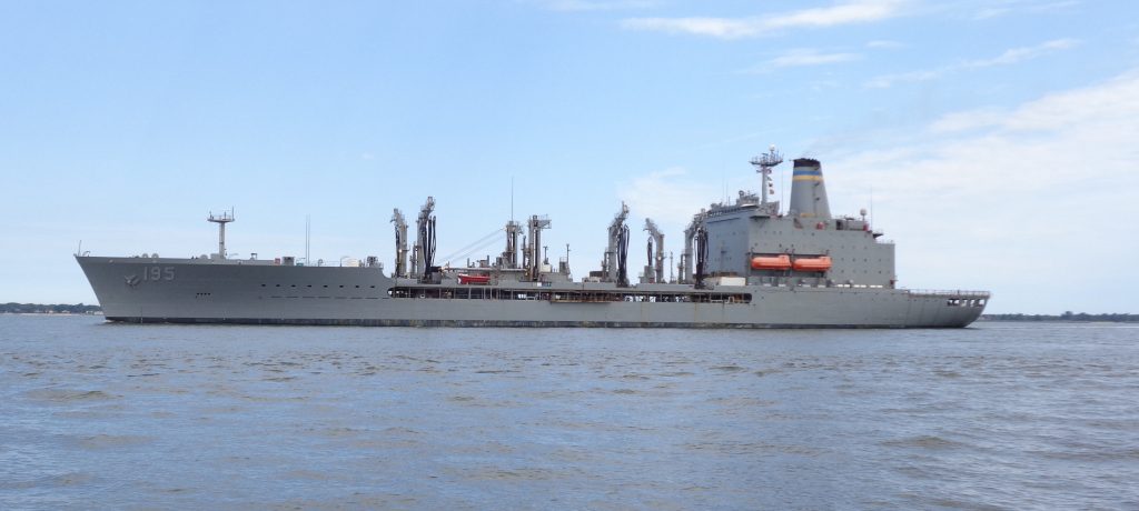
The ICW ends in Norfolk, VA, which is home to naval stations, cruise ships and other industries, so lots of big boats. You have to pay attention there, these boats go pretty fast and they are big. Here’s a few pics.
I finally left the Intracoastal waterway as I entered the Hampton River outside Norfolk. From there I headed up the Chesapeake Bay and have been sailing around here for a week or so.
The Chesapeake Bay
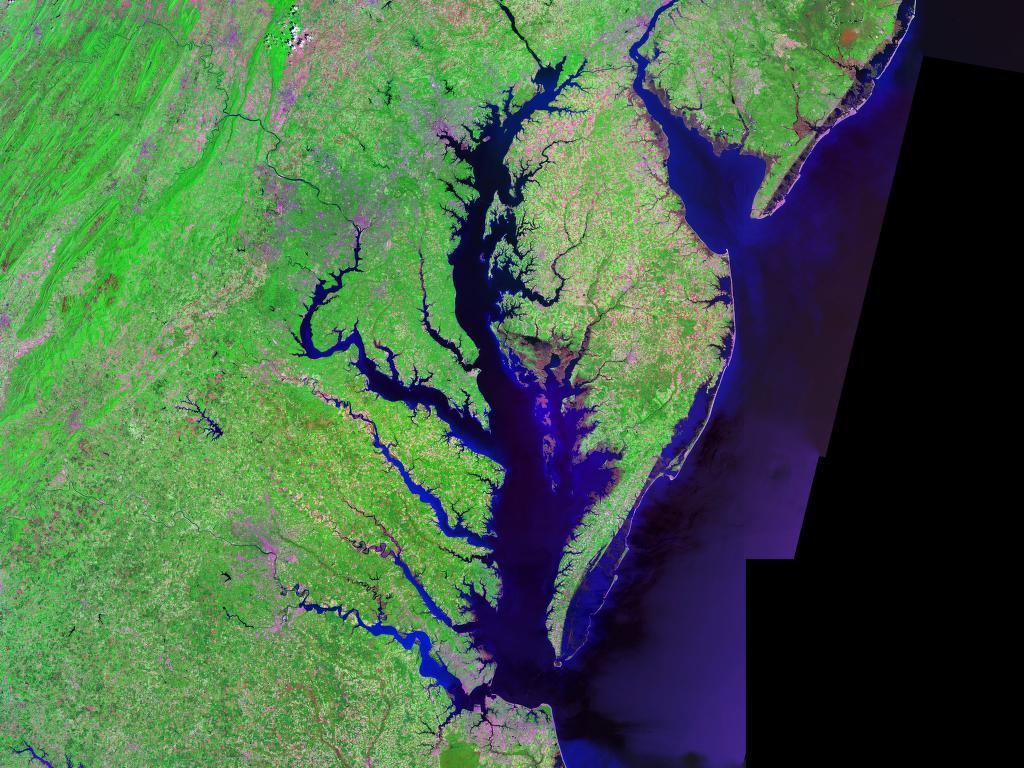
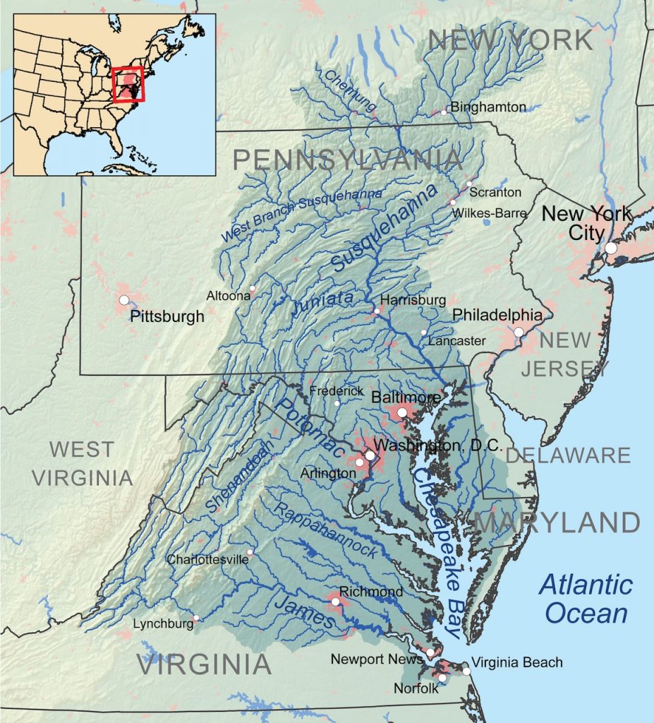
The Chesapeake Bay is an estuary in the states of Maryland and Virginia that covers an area of 64,299-square-miles. With its northern portion in Maryland and the southern part in Virginia, the Chesapeake Bay is a very important feature for the ecology and economy of those two states, as well as others surrounding within its watershed. More than 150 major rivers and streams flow into the Bay which covers parts of six states (New York, Pennsylvania, Delaware, Maryland, Virginia and West Virginia) and all of Washington, D.C. / District of Columbia.
The Bay is approximately 200 miles long from its northern headwaters in the Susquehanna River to its outlet in the Atlantic Ocean. It is 2.8 miles wide at its narrowest and 30 miles at its widest. Total shoreline including tributaries is 11,684 miles, average depth is 21 feet, reaching a maximum of 174 feet. Known for both its beauty and bounty, the Bay has become “emptier”, with fewer crabs, oysters and watermen (fishermen) in past years. Recent restoration efforts begun in the 1990s have been ongoing and show potential for growth of the native oyster population. The health of the Chesapeake Bay improved in 2015, marking three years of gains over the past four years. Here is a landsat photo and a map of the watershed.
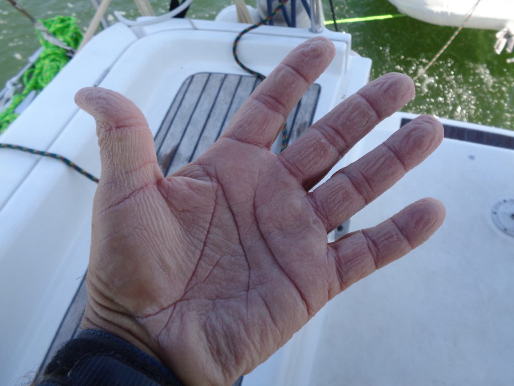
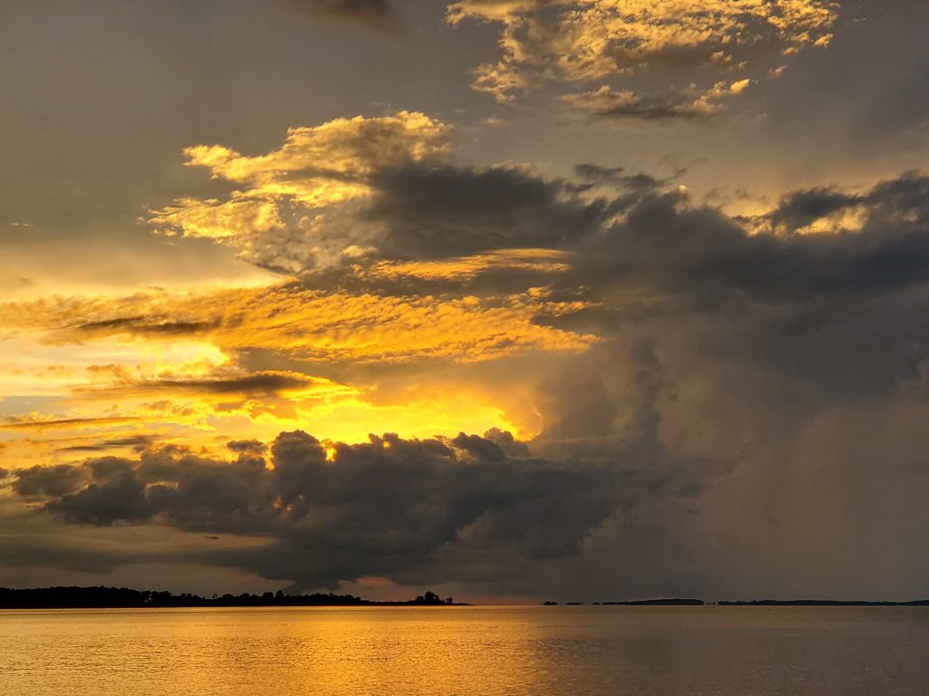
Some photos from Chesapeake Bay. One day, after a heavy rain I had to bail out my dinghy, leaving me with the dreaded wrinkled fingers.
I started seeing jellyfish float by. I knew some could sting but I wasn’t sure about these. I have been swimming around the boat and just jumping in to cool off at the end of the day. Well one day I got stung by one of these monsters. It was incredibly painful. I had no idea. I thought it was like a bee sting or something. But no, the jellyfish left welts on my side that lasted for a week. As it happens I was not wearing a bathing suit so it could have been worse. Ouch.

Here’s some video I shot of the creatures. Be careful, these guys are no joke. Do not swim when they are around.
I had another scare one day while at anchor in a small bay. I was waiting for some spare parts to show up so I just sat around doing nothing all day. There were reports of a storm approaching but they had been saying that for a few days and nothing happened. Well at about 5 pm, a gale suddenly whipped up. Out of nowhere the wind went up to 40 mph, with gusts up to 60 mph. Within seconds my boat was pushed almost on its side. I felt my anchor pull loose and drag on the bottom. To make it worse, another sailboat was anchored behind me, so I was drifting into it. As luck would have it, my engine was disabled because of the spare parts I was waiting on, so I had no engine.
The only thing I could think of was to deploy my second anchor, which I keep stored at the bow. By this time I was right next to the other sailboat, about 30 feet away. Thankfully the wind did not push me into it. That would have been a disaster. I continued to be pushed back and was approaching a reef when the wind died down and the second anchor held. I was about 20 feet from the reef. I then spent an hour trying to get everything settled again.
So that’s sailing: several hours of complete boredom followed by a few moments of sheer terror. I think I lost a few years off my life in that hour.
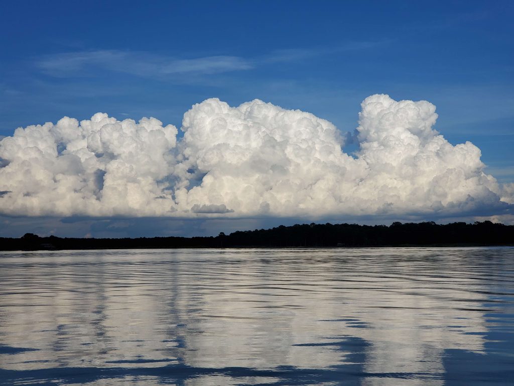
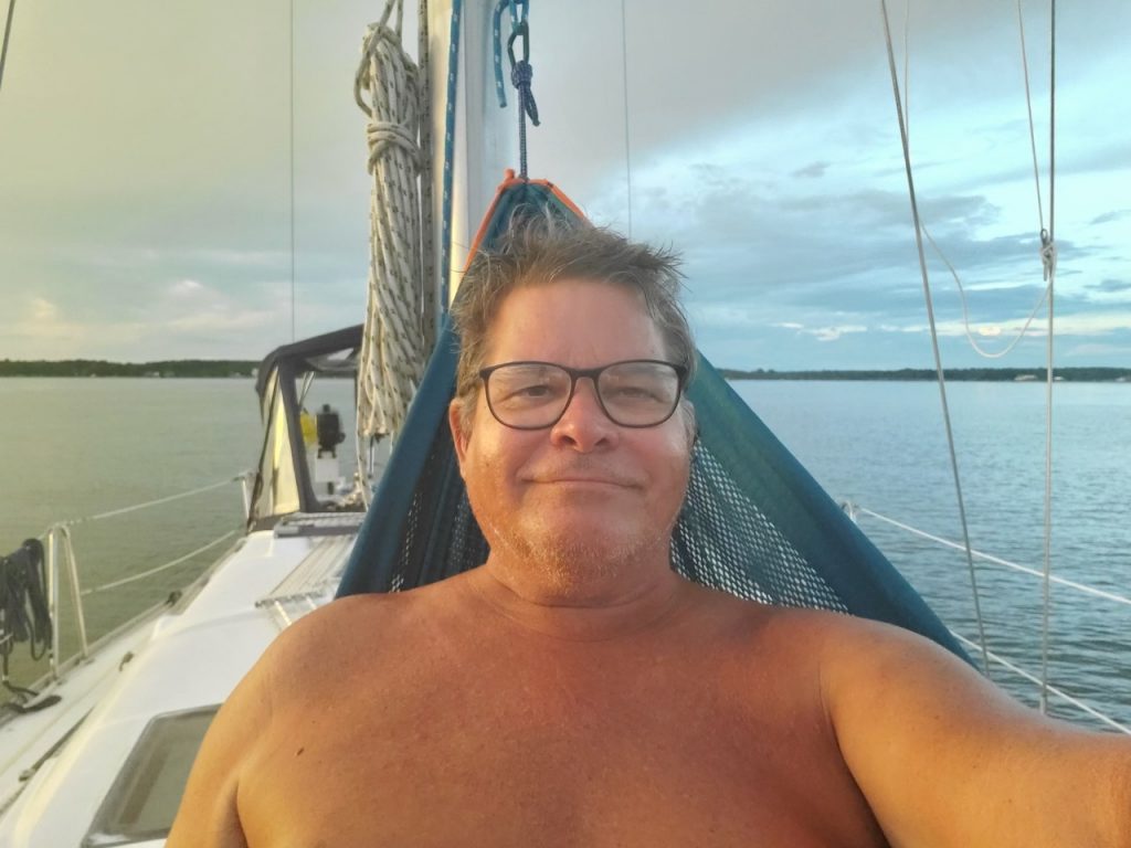
Moving on, the heat has been intense. I finally put up my hammock that I have been carrying around and at sunset, weather permitting, I can cool off by swaying in the hammock. Makes up for the panic attacks. Here are some views and a short video clip.

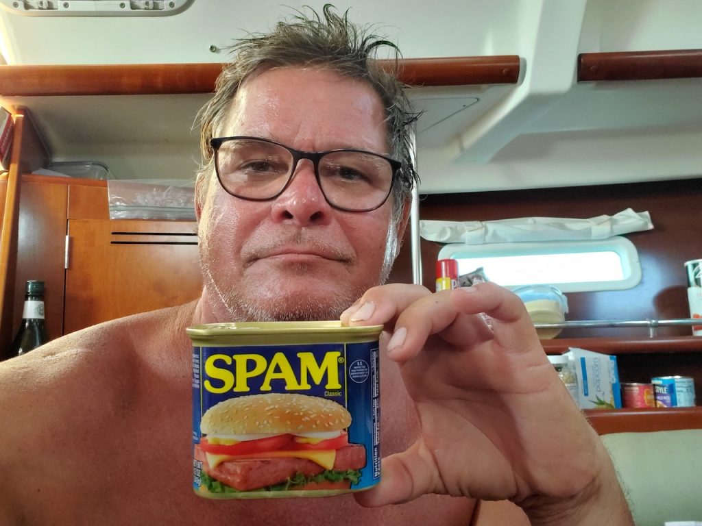
Finally, food. My diet has been pretty bad on the boat. I only stock up on groceries about once a week. So I have fresh veggies and fruit for a couple days then all the perishable stuff gets eaten so I am reduced to cans of soup, ramen, pasta, rice and tuna. I have a small oven so I’ve been baking bread which is nice. I thought I would catch more fish, but have not had luck lately. I caught a blue crab about a week ago. I managed to get about a cupful of crab meat. Tasty, but just an appetizer. My refrigerator is about the size of a hotel one, with a freezer that fits a tray of ice cubes and one or two other small things. Longer term I need to figure out a better system.
You know times are tough when you are reduced to eating Spam.
Well that’s it for now. I’m going to stick around here for a while. I have to haul the boat out to do some maintenance next week. Then I still want to head for the Bahamas. But oh boy, hurricanes.
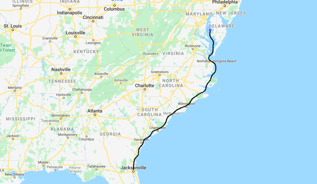
Here’s my route so far.
Hi Kev –
Gorgeous sunset photos! You really do have to be prepared to think fast and act faster on this adventure, don’t you?! It’a sure to keep your mind more nimble than crossword puzzles!
I’m sure you’re aware of travel restrictions for Americans in the Bahamas. Thought I’d send this latest link from the U.S. Embassy anyway.
https://bs.usembassy.gov/health-alert-the-bahamas/
Have you had the chance to meet many other boaters along the way?
Be safe!
Debbie
Hey Deb, yes things can go south very fast on a boat in a storm. Keeps me on my toes.
As for Bahamas, it changes week by week so I don’t know. Depends on the hurricanes too.
Hi Kevin. Love to reconnect with you since you visited us in Kenya. By the way I have a great spam recipe for you. I am out of Kenya on my own and in Arizona living a life a bit like you. Blessings Greg Snell