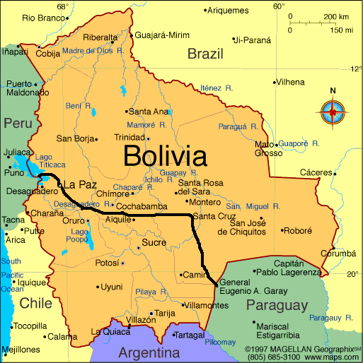
Well I can confirm that there are mountains in Bolivia. Lots of them. Big ones. And the roads among the mountains are not all paved which makes it impossible for me to cycle uphill for very long. But first things first. Here is my intended route in Bolivia.
I spent a couple days in Santa Cruz preparing for my trek into the mountains. My plan was to cycle from Santa Cruz to Cochabamba, a distance of about 500 km or about 310 miles. I knew it was hilly but my map said the road was paved. Now, I don´t trust maps. I usually try to get two or three just to compare them. In this case I bought three maps and they all showed that the road was paved. Maybe it was paved years ago, but not anymore, as I found out half way through.
But before leaving Santa Cruz I wandered through the market area and took these pix. It was a fascinating place, full of energy and excitement.


Once leaving Santa Cruz the road started going up and was paved for the first few days. I stopped in the town of Samaipata where I toured some old pre-Inca ruins and took a day to hike through the forest observing giant ferns. Here is a shot on the way to Samaipata and a look at the the town.


Camping was difficult because, well, mountains have steep sides to them and it is not always easy to find a flat spot out of the way. Once I even had to sleep in a guy´s garage because there was no other accommodation around.

This was in the small village of Mataral, where I took a walk to the town plaza and saw some kids playing. I took this pic of them.

There was another market in the town of Comarapa, about half way through. For some reason I love shooting the market scenes. This woman demanded 1 boliviano (about 15 cents) after I took the photo.

A shot of Comarapa: 
After Comarapa things got real tough. The pavement ended and I was forced to walk my bike for 20 km uphill in dust and rocks. Here I am enjoying the walk.

The road kept going higher as night fell. Finally I found a flat spot by the road at 1700 meters and camped there. Here is a shot of the site.

The mountain roads were brutal. Even when there was a downhill it was bumpy and dangerous. The roads wound around the mountains like coils.


I saw dozens of little memorials like this one to people who had died on the road, probably by falling over the side.

I was going 30-40 km per day. At that rate it would take forever. I was not having any fun. So, out of desperation I flagged down a truck and got a lift for about an hour and a half until the pavement returned. I could not believe how far we went. It would have taken me a week to cover the distance. Up and down thousands of feet on gravel roads, few places to get food or water, and few places to pitch a tent. As it was I ended up in a small town in a stinky room with no electricity or hot water. But at least I was out of the dirt and dust. The “hotel” was basic. All they had for dinner was soup, which I devoured, except for the chicken feet:

Once on the pavement again things went better, but I kept climbing, and climbing, and climbing. I was not sure how high the road went but it finally topped out at 3600 meters (about 12,000 feet). The amazing thing is that people actually live up there. They are mostly Quechua-speaking indigenous people who eke out a living growing crops or raising livestock. I can´t imagine it. It was cold, windy and desolate. Here are some of the people I came across. They are very dark skinned from the altitude I guess. They are descended from the Incas and still speak the Inca language.


Here are a few shots of the landscape at the highest point, 3600 meters (11,000 ft). It was incredibly windy.


But once I crossed the high pass the fun began. I zoomed downhill for about 25 km. It was a newly-paved road too, and was even still closed to traffic so I had the whole road to myself. It was great. I clocked my top speed at 63 km/hour (about 40 mph). I could have gone faster but it was windy.
Near the bottom of the valley I encountered dozens of vehicles stopped and people loitering about. I asked what was going on and that´s when they told me the road was closed for construction. There are no signs or anything, the Bolivians just pile rocks across the road to indicate you can´t pass.


I finally coasted in to Cochabamba after eight days with sore knees, a burnt face and a bit woozy from the ride, only to discover my rear rack had broken. I wired it together but it won´t last. So I need to either get it fixed or get a new one. Ah yes, always a challenge to overcome.
Apparently you are on a pretty flexible time table; at least I hope so.
I am tired just reading this. Can’t imagine how you are doing it. Doesn’t the altitude get to you. How can you cycle at 12,000 feet? If I run at 6,000 feet I get winded.
Great reading and good luck in Peru.
Kevin, finally caught up with your blog. I am stunned at what you are doing and are going through. I continue to wish you good luck -and it looks like you might need it- as you go through this amazing trek. I hope you are planning on publishing a book out of this, or something. The blogs are more and more engrossing as you go along, I’m not sure why. Something fascinating about following an adventure as it unfolds, almost live. I love the contrast in the pictures of you at Mercedes (posted 8/29) and at Filadlefia (posted 9/26), amusing and scary at the same time! Can’t wait for the next entry.
Bernard
You did not say whether you paid the 1 Boliviano or not to the lady of whom you took the photo in the market. I noticed 2 cars in Camparapa – was that it? Can you not get your broken rack welded. Somebody must have even a primitive repair shop. I was surprised to have found some of the things I did in these remote little villages in Costa Rica. Kev–I think you are a masochist–but then again I think I was also ” in the old days” Love DAD
ON THE OTHER HAND-YOU MAY NOT BE ABLE TO FIND MUCH IN THESE REMOTE VILAGES. iT APPEARS THAT BOLIVIA IS CONSIDERABLY MORE BACKWARD THAN COSTA RICA YOU GET INTO THESE LITTLE TOWNS IN THE MAOUNTAINS (SOMETIMES ACCESSIBLE ONLY BY HORSE OR MULE AND YOU FIND YOU ARE BACK 200 YEARS) WITH THE EXCEPTION HOWEVER—TO DAY—OF THE CELL PHONE AND SATTELITE T.V. IIF YOU CAN AFFORD IT.—–LOVE DAD
I did pay the 1 boliviano to one of her kids. As far as the rack, it is aluminum and that is a difficult metal to weld. I think I can find one in La Paz although it may be heavier than my current one.
I can relate to the “paved road” indicated on the map. I remember riding out of Calgary towards Banff. Sure enough, the map told us there was a paved secondary road. Off we go, only to hit rocks coated w/ asphault goo that melted in 85 degree weather. Our tires got stuck in the goo and we had to walk it. We ran into a similar situation riding through the Crow reservation. A road a lots of big rocks. Hope you have plenty of tubes.
Do you talk to yourself a lot? What books are you reading? Keep it coming. May the force and the wind be with you, Laura
Hey Laura, believe it or not, after 2200 km I have not yet had a flat tire. I bought some tough tires and they are doing a great job.
As for talking to myself, yes I am doing that more and more. I think I am starting to get a little wierd.
I am reading a variety of books: one Katrina got me for Christmas about five years ago called “The Ancestor’s Tale: A Pilgrimage to the Dawn of Evolution”, by Richard Dawkins. Fascinating book. I also found an English language version of Sherlock Holmes in Paraguay that I bought.
Hi Kevin,
Your mention of the roadside markers reminded me of a journey I made many years ago (by bus I hasten to add) between Srinagar in Kashmir and Leh in Ladahk. It was only “passable” in the summer and it took two days. As the road zig-zagged ever upward with a sheer drop on one side, every so often there was a roadside marker inscribed with a victorian phrase extolling the virtues of patience or the price of being hasty etc.
Bolivia sounds a bit like Ladahk. It was just like the moon,completely bare except for a narrow green strip on occasional flat pieces of land next to the rivers .Leh was at 12,500ft (still is I hope) and I recall finding it difficult to sleep. and definitely didn’t do any cycling.
I was reading that a man has just swum across Lake Titicaca. Took him 6 hours. I’m sure you could do better ?
The photos are great. I like the ones with the kids and of the markets the best. Keep it going.
Hi Kev –
Nicole D. just turned me on to your blogsite and I’m blown away.
I’m starting from the beginning and working my way up to the present day. I just had to comment on one thing. I was a NYS Parole Officer and spent 13 years in the South Bronx chasing down parole violators. I thought I was made of pretty hearty stuff until I started reading your entries. Chicken feet in your soup??? That’s scarier than anything I ever faced which includes having to wrestle guns and knives away from convicted felons. You’re a better man than I am, Gunga Din.
Rick